As part of that summer, we were tour guides on the 1910 Fire Tours. Paul portrayed Ed Pulaski, and I portrayed his wife, Emma Pulaski. We would take people on the tour up to the Pulaski Trail trailhead, and walk along the part of the trail that was paved. Ever since then I have wanted to hike the Pulaski Trail.
I had hiked it one other time, during the spring of 2010. But I don't think I got the full advantage of the experience. It was with my friend Marian, and a group of students from Mullan. It was pouring down rain for the majority of the hike that day, so I didn't really see a whole lot of the trail coming up or coming down.
Today I finally got to hike to the top of the trail and back down, and take full advantage of the hike, looking at the interpretive signs along the way, and taking photographs of the beautiful scenery.
My friend April #1 joined me on the hike. As April has confessed many times, she is really not really into "nature", and between me and her husband and son, she has experienced quite a bit of nature in the last few months.
But April is a trooper, and we hiked the four mile round trip trail to the Pulaski Tunnel site and back. Fortunately the temperature cooled down today, but the sky was still hazy from fires in Washington state. But I felt like this was quite fitting for our hike up the trail learning about the 1910 fire.
Here are some images of our day.
Here April is at the start of the trail. The tools on either side are called Pulaski's. Ed Pulaski designed them and used them when he worked for the Forest Service.
Along the way, there are many interpretive signs that tell about Ed Pulaski, his story, and information about the 1910 fire. They are all very interesting.
Other signs point you in the right direction.
This points to some old mining equipment still up on the trail.
This is a plaque remembering the men who died in Pulaski's crew.
There are many snags along the trail that are charred and are remnants of the 1910 fire.
Here is one they singled out.
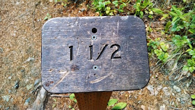
As you hike along the trail, there are markers every quarter mile to show you your progress.
Here we are at the top....we made it!!!
When you reach the top, you look across the creek to the Pulaski Tunnel. Ed Pulaski took his men and led them to this tunnel and saved them during the fire.
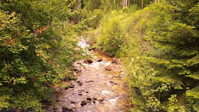
The trail follows Placer Creek, and there is some beautiful scenery along the way.
There were wildflowers along the trail, including the beautiful state flower, the white Syringa.
There were many benches along the way to stop and rest if needed.
The hazy sky.
Along the path.
When we reached the end, we were greeted by Isadora, this beautiful half black lab/half greyhound dog that belongs to my friend Rhonda. April and I fell in love with this dog.
You hike about 800 feet from the trailhead to the Overlook Loop. There are a couple of steep places, but nothing too difficult. We both enjoyed the level of difficulty of the trail, and the beauty of our surroundings. It took us about 2 hours to get from the trailhead to the top, with stops for taking photos and resting. It took us about one hour to come back down.
If you want to find out more about the Pulaski Trail, you can visit this website here.


No comments:
Post a Comment